Mt. Whitney Webcam 1

Webcam 1 Legend
Mt. Whitney Webcam 2

Webcam 2 Legend
Mt. Whitney Timelapse
Owens Valley North

Owens Valley North Legend
Owens Valley South

Owens Valley South Legend
Previous Thread
Next Thread
Print Thread
Joined: Jan 2003
Posts: 548
Member
Member

Joined: Jan 2003
Posts: 548
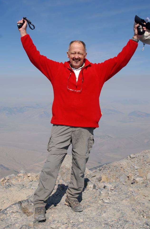
Last week, the third time proved the charm as a friend and I summitted Borah Peak, the Idaho highpoint. A mere 12,662' but still a worthy climb, four miles out and one mile up, with significant exposure along what is aptly referred to as "Chicken-Out Ridge" before you hit the final use trails to the summit.

State highpoint #44 for me. (Tried Kings Peak in Utah again also but once again ran into weather issues, so only 50/50 for summits on this trip.) I'll post a link to the trip report once I have it online.


Joined: Mar 2003
Posts: 116
Member
Member

Joined: Mar 2003
Posts: 116
Congrats on that summit.
I did it (along with Kings) in 2009, and Borah was the hardest downhill walk I've ever done.

Joined: Jan 2003
Posts: 548
Member
Member

Joined: Jan 2003
Posts: 548
I finished the trip report and posted it to my web site. Now looking forward to next summer for another shot at Kings and hopefully also Gannett (WY) and Granite (MT) in a longer trip out west.


Moderated by  Bob R, Doug Sr 

Link Copied to Clipboard
Mt. Whitney Weather Links


White Mountain/
Barcroft Station

Elev 12,410’

Upper Tyndall Creek
Elev 11,441’

Crabtree Meadows
Elev 10,700’

Cottonwood Lakes
Elev 10,196’

Lone Pine
Elev. 3,727’

Hunter Mountain
Elev. 6,880’

Death Valley/
Furnace Creek

Elev. -193’

Powered by UBB.threads™ PHP Forum Software 8.0.0
(Release build 20240826)
Responsive Width:

PHP: 7.4.33 Page Time: 0.052s Queries: 20 (0.030s) Memory: 0.7013 MB (Peak: 0.7452 MB) Data Comp: Off Server Time: 2025-04-25 11:27:44 UTC
Valid HTML 5 and Valid CSS