Mt. Whitney Webcam 1

Webcam 1 Legend
Mt. Whitney Webcam 2

Webcam 2 Legend
Mt. Whitney Timelapse
Owens Valley North

Owens Valley North Legend
Owens Valley South

Owens Valley South Legend
Previous Thread
Next Thread
Print Thread
#95012 05/12/13 08:15 PM
Joined: May 2004
Posts: 538
Member
Member

Joined: May 2004
Posts: 538
Desiree, Frank and I went to do Langley but when we got to the top of New Army and saw Langley it had more snow then we thought it would.. Des and I walked down to Army Pass to see what it looked like and it was full of snow, I walked maybe 20ft on the pass and it was a NO way. We walked over to Cirque Pk snow was deep on that side walked on the lower side and kept going on the side until we met Tracie, Talus, Carole and Jim heading for Cirque.

It was a great day hiking with friends beautiful area up there.. Nice to see everyone at the portal.. Good to see you again Richard..

Laura nice to see you again and it will be nice to see your pictures.

Pictures here New Army
mark
[img][img]http://farm8.staticflickr.com/7333/8732337872_ebf2f001a3_c.jpg[/img][/img]
[img][img]http://farm8.staticflickr.com/7384/8732326380_2bfe53c155_c.jpg[/img][/img]
[img][img]http://farm8.staticflickr.com/7400/8732325630_52df0dca85_c.jpg[/img][/img]
[img][img]http://farm8.staticflickr.com/7418/8732317226_d45ff0b5c7_c.jpg[/img][/img]

Joined: Dec 2002
Posts: 613
Member
Member

Joined: Dec 2002
Posts: 613
Great pics.... I was up there at Lake 4 and then Long Lake for a short day hike on the same day.

And, I ran into Moosie with her friend Bob. They went up the chute at Army Pass and down New Army.

paul

Joined: Oct 2004
Posts: 119
Member
Member

Joined: Oct 2004
Posts: 119
Great photos Mark, really nice day all around. Weather was perfect and hiking conditions were good as long as you don't mind snow or a rock or two.


Mark finishing New Army pass, the only difficult section with ice beneath an bit of wet snow.


Mark climbing the New Army Cornice


Frank A
"If you want to go fast, go alone. If you want to go far, go together"

African Proverb
http://www.flickr.com/photos/asbufra/
Joined: Mar 2003
Posts: 838
Member
Member

Joined: Mar 2003
Posts: 838
Beautiful pictures Mark! Sounds like there was quite the party... on the mountain and at the Portal! Nice!!


"What we have done for ourselves alone dies with us; what we have done for others and the world remains and is immortal." Albert Pike
Joined: Aug 2006
Posts: 2,391
Member
Member

Joined: Aug 2006
Posts: 2,391
Somehow we managed to never see anyone up on the passes themselves, but it was great to catch up at the Portal! Shootin' the breeze (and the ginormous mozzies!!) on Saturday afternoon was really special.

Bob Huey and I had planned originally to cross the Crest and head for Soldier Lake, but weather on Friday and a few other issues pushed us to camp at one of the lakes below Army Pass. Reaching there by 1pm, we opted to recon (Old) Army Pass and determine its feasibility for an approach to Langley.

Bear with the photos , folks. The light shifting around with the clouds made for a photogs paradise up there...


(Old) Army Pass:


We opted for the chute in the middle of the photo. Right side had a rim-to-rim cornice hanging over it. Chute starts at about 35 deg, increasing to 45 at the narrows and to the top.


It started to snow when we hit the top, just a squall, but breathtaking...


We headed over to the old trail to see if we could pick our way back down, but that was a no-go (at least for us) without pickets/ropes/etc. I tried to make sure this wasn't tilted for emphasis at all:


So, we opted to loop back to camp via NAP. There was about a 40-50ft drop down from the edge that wasn't corniced, soft/wet new snow over a firm base that was most safely done with crampons and axe. Not exactly a nice landing if the snow gave way.

[img]http://farm8.staticflickr.com/7294/8733200555_eef14831ac_z.jpg[/img]

[img]http://farm8.staticflickr.com/7322/8734324680_ced7fab331_z.jpg[/img]

[img]http://farm8.staticflickr.com/7302/8733209205_1288a02bf3_z.jpg[/img]

The dry conditions may lull you into a sense of not needing what someone called their "hard-core gear", ie: axe/crampons/knowledge of how to use both. <insert eye roll> Just like last year, folks: those who equate "low" snow year to "NO" snow year will another thing coming. We ran into multiple parties on their way in who voiced intentions of ascending Army Pass and descending NAP on their way to Langley. To put it bluntly: spring conditions DO exist throughout the higher elevations and crampons/axe are not "hard-core" gear. Just stop and think for one moment before you get yourself into a situation from which you cannot back off.

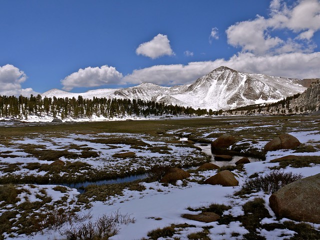
Heading out early Saturday allowed for more gorgeous light, and at least one critter who had no fear:

[img]http://farm8.staticflickr.com/7285/8734360966_f722706732_z.jpg[/img]

[img]http://farm8.staticflickr.com/7305/8734364508_4f42c83417_z.jpg[/img]

[img]http://farm8.staticflickr.com/7299/8734372652_cd5def536f_z.jpg[/img]

Happy belated Mother's Day to all!!

-L


Flickr Pics

Think outside the Zone.
Joined: Jul 2007
Posts: 696
Member
Member

Joined: Jul 2007
Posts: 696
Nice photos and TRs Mark and Laura. Especially the one of Mark near the pass, the meadows and of course that happy critter.

Fun times up there!

Joined: Apr 2008
Posts: 51
Member
Member

Joined: Apr 2008
Posts: 51
Nice pics Laura. Can't wait to get up there.

Obviously the knee is doing ok?


"Climb the mountains and get their good tidings"
John Muir
Joined: Aug 2006
Posts: 2,391
Member
Member

Joined: Aug 2006
Posts: 2,391
Knee is doing great! It's been motivation to train other than the weekends that's been killing me! grin

But that's turning a corner, too. Started my birthday challenge a few days ago and now just need to stick to it. wink


Flickr Pics

Think outside the Zone.

Moderated by  Bob R, Doug Sr 

Link Copied to Clipboard
Mt. Whitney Weather Links


White Mountain/
Barcroft Station

Elev 12,410’

Upper Tyndall Creek
Elev 11,441’

Crabtree Meadows
Elev 10,700’

Cottonwood Lakes
Elev 10,196’

Lone Pine
Elev. 3,727’

Hunter Mountain
Elev. 6,880’

Death Valley/
Furnace Creek

Elev. -193’

Powered by UBB.threads™ PHP Forum Software 8.0.0
(Release build 20240826)
Responsive Width:

PHP: 7.4.33 Page Time: 0.036s Queries: 30 (0.016s) Memory: 0.7350 MB (Peak: 0.8141 MB) Data Comp: Off Server Time: 2025-05-01 13:07:29 UTC
Valid HTML 5 and Valid CSS