|
|
Joined: Dec 2002
Posts: 597
Member
|
|
Member
Joined: Dec 2002
Posts: 597 |
The reason a real signal mirror works so well is the "retro-reflective aiming aid" in the hole (so it's not really a hole). Looking through it, with the mirror held close to your eye, the location of the spot is vividly obvious even if it's too far away to actually see it hit. Move the image of this spot over to your target, and you're "spot on." No guessing as to where the reflected light is going, and--for the people in the helicopter--no guessing where it is coming from.
And before you trust your potential survival to a reflective blanket, suggest you spread it out on the ground and then go some distance away. Look back and see how it shows up. Note: If you lay it perfectly flat, it will show only the reflection of the sky. I'm sure it will help, though, as will anything brightly colored and contrasting.
CDs vs signal mirrors is a no-brainer. (For example, Adventure Medical's mirror is $9, weighs 0.3 oz)
|
|
|
|
|
Joined: May 2008
Posts: 154
Member
|
|
Member
Joined: May 2008
Posts: 154 |
Shot down in flames - It's OK, we are all a little wiser now.
|
|
|
|
|
Joined: Jun 2003
Posts: 271
Member
|
|
Member
Joined: Jun 2003
Posts: 271 |
Hold out your arm and make a "V" with first two fingers. With the other hand hold signal mirror near your face. Facing into the sun of course.
Aim the "V" arm at the target (helicopter? Person wearing a very bright orange shirt?). Use the "V" as your "sight" and flash the sunlight through it at the target.
I've used this in the Mojave National Preserve and flashed someone who was easily 2 miles away and confirmed via radio that he instantly saw me.
Oh, I was using the mirror in my compass BTW. If you have a compass, you already have a signal mirror.
|
|
|
|
|
Joined: Jul 2009
Posts: 556
Member
|
|
Member
Joined: Jul 2009
Posts: 556 |
[quote]
While I'm here, I'll comment on a post somewhere around here on why hikers are discouraged/prohibited from participating. A couple of good answers were given. The two main reasons are safety -- you just can't have unsupervised, random people wandering around in an active search area. It's too dangerous for the searchers and the hikers. You've got helicopters operating, searchers perhaps on technical terrain who don't want anyone above or below them, and searcher's time taken by answering questions and trying to direct well-meaning but untrained hikers.
As important, people in the search area mess up critical clues: covering up or leaving their own foot prints: they may leave garbage or equipment that will confuse SAR teams as a possible clue, and distractions for both ground and air searchers (a helicopter can't distinguish between a hiker and who they're looking for -- a SAR team will have a radio to ID themselves).
George Interesting how philosophies on this differ based on geography. Some of you may recall almost two years ago that Meredith Emerson, an Emory University student here in Atlanta, went missing during a dayhike in the Blue Ridge mountains in northern Georgia. The Blood Mountain area, to be specific - one of my favorite local stomping grounds. SAR parties searched for over a week before her body was found - murdered and mutilated in the wilderness by that SOB Gary Hilton. He also was charged with murdering an elderly couple hiking just across the state line in North Carolina, and probably another female hiker in Florida, all around the same time. Hiking in North Georgia was touch and go for quite a while after that - I rarely ran across solo hikers, and never a woman alone. The point, though, is that during the days of searching - which was actually in a fairly confined area in the Blood Mountain Wilderness, way smaller than the Whitney Zone - hundreds of local volunteers were used in addition to the state and local SAR teams. Practically anyone willing, especially if on horseback, was encouraged to participate. The difference in how this was handled, versus say a Wade Brunette in the Whitney Zone, I think has mostly to do with terrain. If you've not been in the southern Blue Ridge mountains, they are thick, boys and girls. Dense forest, shrubbery, undergrowth, kudzu, small mountains and a bunch of 'em, ravines and gulches galore. You could be virtually standing on a dead body five feet off the trail and never realize it - seriously. Remember, this is where that jackass Eric Robert Rudolph hid from literally thousands of FBI, GBI and ATF agents for years after the Olympic and abortion clinic bombings. To effectively search an area like that in a relatively short time, you really need a lot of assets on foot and horseback. Air searches were conducted, but they're pretty useless unless smoke is spotted - it's nothing but a canopy of treetops from up above. I also believe that the priority was on quickly finding a live, distressed hiker, so trampling potential evidence was a distant second in the scheme of things. When the "R" in SAR turns into "Recovery", well, evidence and clues become a higher priority. As long as it's viewed as a rescue mission, pretty much everything else is secondary to having a set of eyes zero in on that missing person. I understand that the Sierra poses a different risk for hundreds of searchers tramping around off-trail, so that was really my observation - geography and conditions often dictate how these things are handled.
|
|
|
|
|
Joined: Aug 2007
Posts: 11
Member
|
|
Member
Joined: Aug 2007
Posts: 11 |
Here are some more concepts and info associated with SAR that may add to the general understanding of what goes into an operation.
Most SAR operations resolve themselves very quickly - a few hours at the most and don't ever become the large multi-team operations that the search for Wade became. The local SAR team responds, often within an hour or two depending on incident location and distance the team needs to travel. There isn't all that much incident overhead or bureaucracy that needs to be managed. If an operation exceeds the capacity of the local team to handle the call, i.e., extended searches, large geographic search areas, highly complex rescues, need for specialized resources, etc., then the local sheriff (or responsible agency) can make a request for mutual aid through the state or via predefined agreements.
As was noted in an earlier post, these big multi-team efforts require much more incident management resources to support the field teams. Planning (figuring out what field teams are going to do - where and how can they be used for the greatest good), Operations (managing the teams in the field), Logistics (feeding and supplying the personnel), Command (someone has to be in charge...) are just some of the roles that have to be filled. The size of the command structure can expand or contract based on the needs of the incident.
Spontaneous volunteers (usually members of the general public who volunteer to help) are often a great resource, but have to be carefully managed and incorporated into an operation. This takes lots of planning and management energy. In many cases the effort required to manage these volunteers may exceed the value they can provide. Spontaneous volunteers can often be very valuable in providing eyes and ears that can augment trained resources when doing grid-type searches in appropriate terrain.
Clues - or a lack of clues - are always important when searching for a lost subject. Clues can help narrow a search area or eliminate potential areas. Skilled searchers can use a set of seemingly innocuous clues to zero in on a missing subject like a laser beam. Only after the subject has been located can the nature of the "R" component of SAR be defined. I have seen searches become rescues and I've seen them become recoveries.
|
|
|
|
|
Joined: Jun 2003
Posts: 271
Member
|
|
Member
Joined: Jun 2003
Posts: 271 |
Imagine the liability if one of those volunteers fell off a cliff! Not to mention the moral/ethical quandry it would pose to have put an untrained volunteer out in harms way.
Last edited by ClamberAbout; 11/13/09 09:20 PM.
|
|
|
|
|
Joined: Jul 2009
Posts: 556
Member
|
|
Member
Joined: Jul 2009
Posts: 556 |
Imagine the liability if one of those volunteers fell off a cliff! Not to mention the moral/ethical quandry it would pose to have put an untrained volunteer out in harms way. Clamber, the volunteers were (and are) vetted prior to being assigned search responsibilities. Also, they're generally given non-threatening terrain to scour, and grouped with 1-2 experienced SAR responders. It's not a case of "you go this way, I'll go that way" - it is coordinated and methodical. I'd be shocked if liability releases weren't obtained from each volunteer prior to being allowed to officially join a search segment. "Harm's way" is also very relative to the patch of ground you're patrolling. For most searchers in Meredith's case, the only real danger was a twisted or broken ankle. Certainly snakebite is always a concern, and this is a constant, ever-present danger in Georgia's wilderness (being home to all 4 venomous families in the US - rattler, cottonmouth, copperhead and coral). It just goes with the territory of stepping into the wilderness here (often, just into your backyard, and I live in some of the most dense suburban sprawl in the US). They do, however, tend to disappear when there's a lot of human activity. Bears also were scarce with such a hubub in the search area. Ravines and gulches are pretty obvious, and not very deep. And the last I looked, Georgia's towering, dangerous cliffs pretty much gave up the ghost some umpteen-million years ago. Again, it ain't the High Sierra and conditions are totally different. Stand almost anywhere in the Sierra and you can see for miles and miles. Stand almost anywhere in Georgia's mountains and you may see clearly 50 feet if you picked a good spot - sometimes less than 10 in the spring/summer. I kid you not, there are a great many places where Bozo the Clown could be riding a pink elephant and holding a neon sign, and you'd miss it from 50-100 feet. Almost every bear, deer or boar encounter I've had in my years hiking these trails came as a surprise from less than 100 feet away - usually to both of us. The comments earlier in this thread regarding signal mirrors made me chuckle. In this environment, they're more effective as shaving mirrors. Get to the top of a bald, maybe you have a chance of flashing a copter or search plane. Otherwise forget it. Given those conditions, and the minimal chance of having an air search be successful due to the heavy tree cover, what other options are there to covering the terrain in the time necessary to effect a rescue and not a recovery? Again, you need a lot of eyes to search even a 5 sq mi grid in this type of density, and that is really what I was saying - terrain and conditions dictate SAR operations quite differently from one place to the next. Your point about the liability and/or ethical quandry in having "untrained" personnel participate in a large scale SAR is taken. Hopefully I've clarified that a little better. Counterpoint: How ethical is it to allow someone in distress or seriously injured to die for lack of a timely, adequate response when the resources are available? I don't know which is more right or wrong - I was just observing that the needle does vary widely along this scale from place to place.
|
|
|
|
|
Joined: Dec 2003
Posts: 447
Member
|
|
Member
Joined: Dec 2003
Posts: 447 |
Imagine the liability if one of those volunteers fell off a cliff! Not to mention the moral/ethical quandry it would pose to have put an untrained volunteer out in harms way. Look at all the volunteer fire personnel around the country. Some with no training, just a sign up. Thats what the good samaritan law is for.
|
|
|
|
|
Joined: Dec 2002
Posts: 597
Member
|
|
Member
Joined: Dec 2002
Posts: 597 |
Hopefully, the chances of this happening are smaller now. After years of grumbling about the signage, last August I wrote directly to the superintendent of SEKI. I included several pictures. Got a polite but noncommittal reply, so I thought...Oh well. But on Sunday there were four beautiful new signs in place of the old confusing two, and they are very clear and accurate. I am almost positive they weren't up four weeks ago: 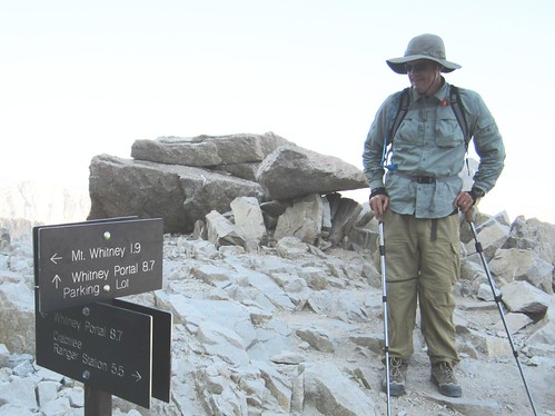 The old signage, with the arrow for Whitney Portal pointing due west--toward Guitar Lake, the Kaweahs, and Fresno:  More pictures here.
|
|
|
|
|
Joined: Jun 2003
Posts: 5,449 Likes: 12
Member
|
|
Member
Joined: Jun 2003
Posts: 5,449 Likes: 12 |
There was a NPS Trail Crew up on the mountain on Tuesday, 06.25.
The new sign was leaning up against the wall at the JMT Junction with all of the backpacks as we passed on our way down. If you noticed a dent in one of the signs, that is because I picked it up to have a better look and after I leaned it back up against the wall, it decided to fall over. Oooops!
Last edited by Richard P.; 07/02/13 02:52 PM. Reason: BTW: after reading some of this thread again... when I see tired hikers on the west side, one of the things I try and drill into their head is that they need to remember to head up and to the left when they get back to the junction. It is too easy to want
|
|
|
|
|
Joined: Jun 2006
Posts: 167
Member
|
|
Member
Joined: Jun 2006
Posts: 167 |
I do remember the solar toilettes at Trail camp when we did our first Whitney in 1992! I don't remember the small enclosed one at the top of the Whitney though! That day they were installing lightning arresters on the Smithsonian hut as some one got electrocuted the prev summer. In 2003 October probably it was too late in the season for the lady to come across any JMT hikers camping at Guitar lake. Very fascinating reading.
Here is the photo from my archives showing the equip delivery on MW for lightning arrester installation.
http://www.flickr.com/photos/25552148@N02/9240280782/
|
|
|
|
|
Joined: Jun 2009
Posts: 327
Member
|
|
Member
Joined: Jun 2009
Posts: 327 |
That's why we can't have nice stuff, Richard... 
Avoiding danger is no safer in the long run than outright exposure. Life is either a daring adventure, or nothing.
Helen Keller
|
|
|
|
|


