Mt. Whitney Webcam 1

Webcam 1 Legend
Mt. Whitney Webcam 2

Webcam 2 Legend
Mt. Whitney Timelapse
Owens Valley North

Owens Valley North Legend
Owens Valley South

Owens Valley South Legend
Previous Thread
Next Thread
Print Thread
#103883 06/24/20 05:31 PM
Joined: Mar 2018
Posts: 49
Member
Member

Joined: Mar 2018
Posts: 49
Hi peeps from Lone Pine area. Everyone ok? Any rocks on portal road?


"Light yourself on fire with passion and people will come from miles to watch you burn."


Instagram: @_helena_borboleta
Joined: Jul 2004
Posts: 50
Member
Member

Joined: Jul 2004
Posts: 50
ABC Network News just featured a clip with the Whitney Portal Store sign. Long range shots show rockslides/dust from various canyons.

Joined: Jun 2020
Posts: 4
Member
Member

Joined: Jun 2020
Posts: 4
Is the trail open to Lone Pine Lake? I know it was, but am unclear if the slide(s) covered the trail or not. Arriving Friday guess we will find out?

Thanks
Scott

Joined: Dec 2002
Posts: 992
Likes: 2
Member
Member

Joined: Dec 2002
Posts: 992
Likes: 2
They evacuated and closed Whitney Portal and are assessing rockfall damage and conditions for the Portal Road and also Horseshoe Meadow Road. I talked to Maura at the Hostel and everyone is okay, just getting a handle on things, cleaning up, and hurrying up to wait (again). I'm sure Doug will give us a firsthand write-up when time permits.

In the meantime, expect either dinosaurs or an alien invasion next week...

Joined: Jun 2020
Posts: 4
Member
Member

Joined: Jun 2020
Posts: 4
Need to decide if I have to cancel our room, today is the last day I can do so....Ugh

Anyone have the inside scoop on the Portal campground and trail to Lone Pine Lake?

Thanks Scott

Joined: May 2003
Posts: 53
Member
Member

Joined: May 2003
Posts: 53
Doug's experience is mentioned in the Los Angeles Times.

https://www.latimes.com/california/story...eastern-sierras

Joined: Dec 2002
Posts: 3,018
Likes: 4
Member
Member

Joined: Dec 2002
Posts: 3,018
Likes: 4
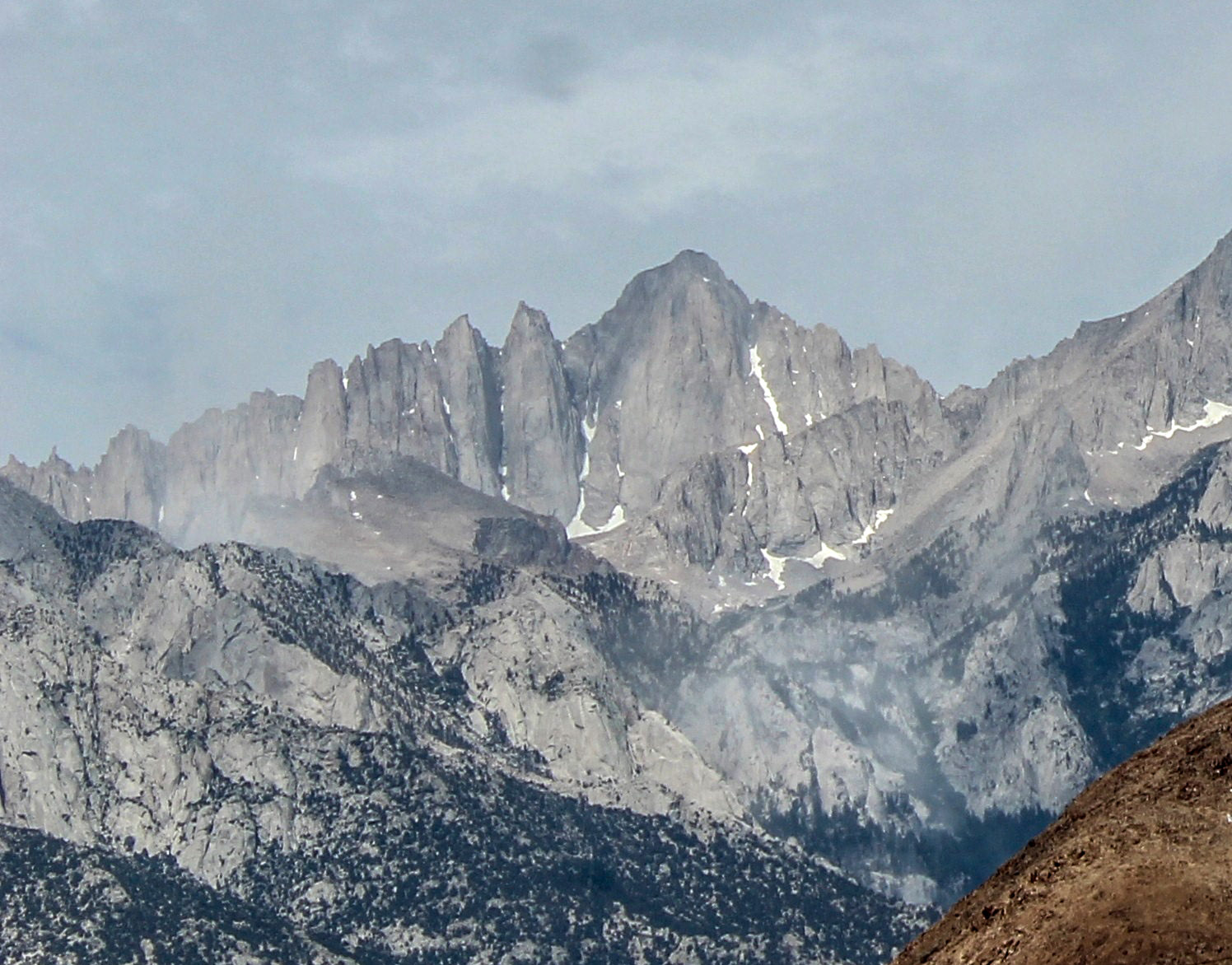
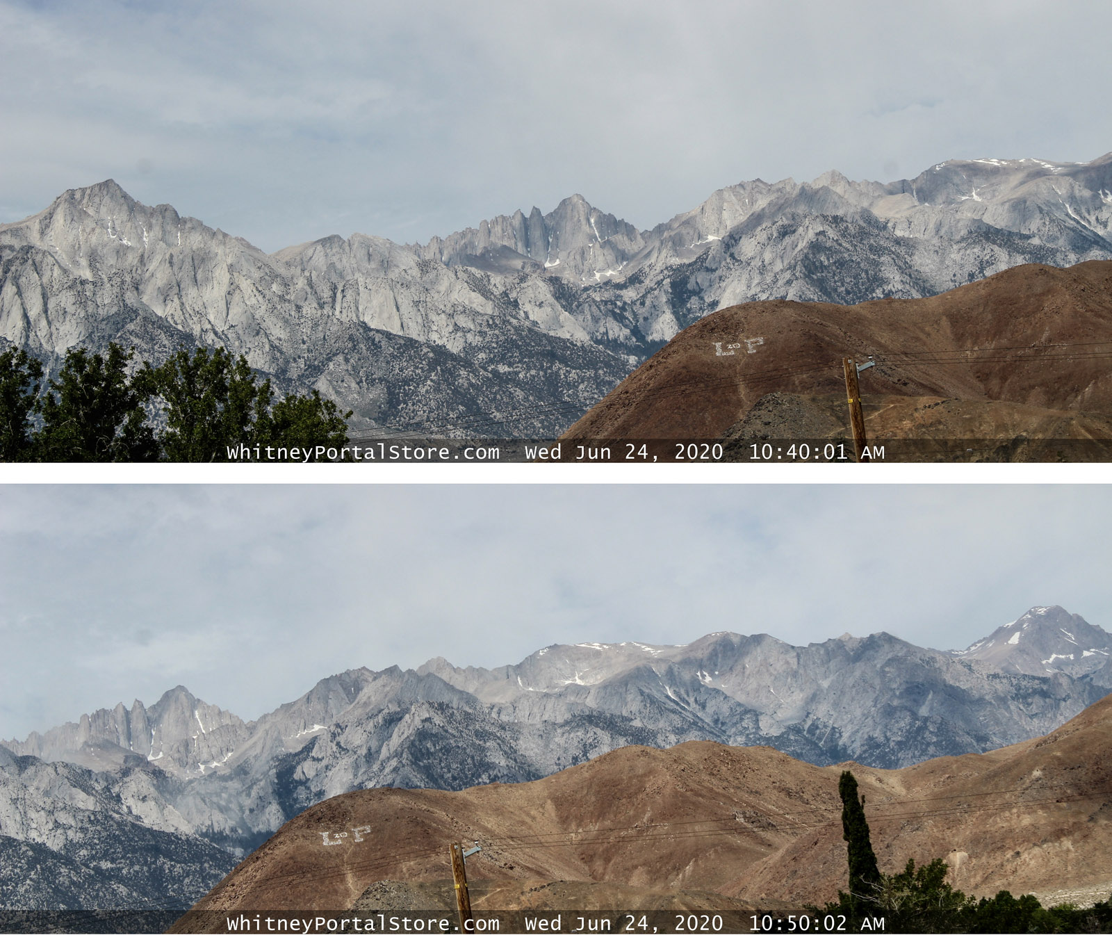
We had an earthquake the other day ,Doug Jr and I was outside talking to Martin , from the Best Western Motel first felt like the average California ho hum wave , but picked up speed and then we heard the rock shearing off Candlelight Buttress. We knew from past rock falls yup they will come into the Portal . Doug ran up the road to get a view and I went up to the top lot to see if we could find the landing site ,it was clear the major fall area was in the backpacker campground area and the walls around the falls were holding ...just a little dust showing.

Doug Jr ran back into the store and called 911 , we then waited for the dust to lift and went down to the area looking for any signs of campers or hikers , Myles and Rob met up about this time and went down the NRT . On the quick search we didn't find anyone or anything that indicated a camper in the campground.

Within minutes Agency crews started to arrive, we closed and went to Bishop for supplies . We hear rock fall often from the Canyon and the area just south of Lone Pine Peak is very active.

A search with dogs yesterday and Rangers are checking the main trail for damage, we have had reports from hikers coming down the main trail seems clear but is being checked.

The main problem now is the chatter, So ONLY trust the Inyo County Sheriffs/FS press releases. They may have local jargon that is not easy to understand for outsiders but the main messages are clear.

Joined: Dec 2002
Posts: 593
Likes: 3
Member
Member

Joined: Dec 2002
Posts: 593
Likes: 3
Doug,

Good to hear that the Whitney Portal Store Crew is OK.

Thanks for the Crew's initial sweep of the area to see if others needed help.

Jim

Joined: Dec 2002
Posts: 992
Likes: 2
Member
Member

Joined: Dec 2002
Posts: 992
Likes: 2
From the cam about ten minutes after the quake, you can see the dust still in the air over the Portal. The cloud above Lone Pine Lake and below Candlelight looks even bigger. Curious how many "islands" the lake has now...


Joined: Jan 2003
Posts: 969
Member
Member

Joined: Jan 2003
Posts: 969
Does Rattlesnake Hill have a new summit?

Joined: Dec 2002
Posts: 992
Likes: 2
Member
Member

Joined: Dec 2002
Posts: 992
Likes: 2
Yes, just like everything else in the area, as you can see from the webcam images only 10 minutes apart. The entire land mass shifted almost 2 miles to the south and dropped over 300' with a tilt of 1.6-degrees. The awesome power of Mother Nature! Still shocked that no one was seriously injured...


Joined: May 2020
Posts: 10
Member
Member

Joined: May 2020
Posts: 10
Originally Posted By Jeff M
The entire land mass shifted almost 2 miles to the south and dropped over 300' with a tilt of 1.6-degrees. The awesome power of Mother Nature!

Sounds good, that means that Whitney will be easier to hike now.

Joined: Jan 2003
Posts: 969
Member
Member

Joined: Jan 2003
Posts: 969
How about the east side of the valley? Did Haystack get unstacked?

Joined: Dec 2002
Posts: 3,018
Likes: 4
Member
Member

Joined: Dec 2002
Posts: 3,018
Likes: 4
At first I thought the camera , but drove up to Rattlesnake today yes it as high as if not Whitney at least Lone Pine Peak. I am never going back to Haystack after the outing this winter.


Moderated by  Bob R, Doug Sr 

Link Copied to Clipboard
Mt. Whitney Weather Links


White Mountain/
Barcroft Station

Elev 12,410’

Upper Tyndall Creek
Elev 11,441’

Crabtree Meadows
Elev 10,700’

Cottonwood Lakes
Elev 10,196’

Lone Pine
Elev. 3,727’

Hunter Mountain
Elev. 6,880’

Death Valley/
Furnace Creek

Elev. -193’

Powered by UBB.threads™ PHP Forum Software 8.0.0
(Release build 20240826)
Responsive Width:

PHP: 7.4.33 Page Time: 0.039s Queries: 43 (0.021s) Memory: 0.7560 MB (Peak: 0.8504 MB) Data Comp: Off Server Time: 2025-04-27 22:48:04 UTC
Valid HTML 5 and Valid CSS