On Wednesday night, Mike (GigaMike) called to say he was hitting the MR as an overnight with his buddie Arthur (DoogieMan), with whom he is climbing Rainier in July. After a little schedule shifting (thanks, Cori!), I was in, and Mike also invited Doug Forbes (Hedgehog) to come along.
Team Hypoxia was set! The four of us met at the Portal for an early start up
Mt. Pancake before hitting the trail.
Some notes from the weekend:
1) The trail is completely clear up to LBSL, except for one small patch that is easily avoided just before the waterfall stream crossing on the south wall below the
E-ledges . It was really warm in the drainage, so I took advantage of dunking my head (well, I may as well have just jumped IN) under the waterfall. Better than coffee! Even the water level at the outlet of LBSL is much lower than two weeks ago, making the crossing much easier.
2) The
snow slope up to the slabs is still intact with a nice boot track to follow. Once you hit the slabs, it's no more snow until you are above UBSL.
Plenty of water available all the along the way, and
UBSL , while not thawed, is close to being so. Lots of fish action in the outlet ponds!
3) My pack was around
42 lbs , which for shoulder season isn't bad! Mike and Arthur tied for lightest at 27 lbs, and Doug's was 38. I got to try out my new
bivy sack and 15 degree bag, COZY! I brought treats:
whiskey for happy hour Saturday night, my din-din of
grilled brats in a marsala sauce w/ fresh veggies over pasta, and dessert: homemade
pineapple-cherry pie (even made the crust myself!). Mmmmm...
4) Thanks to all who were up there right before us who layed out a great boot track. The snow was in great condition from UBSL to the chute, minimal postholing! The one '
annoyance ' was that people seem to be glissading down the boot tracks! Ack! Just one step to the side, folks! The tracks got a bit slippery in spots from this.
5) It was a
party in the chute: as many as
17 people were there Sunday morning. 8 were a guided group from "Climbing for Kids" (congratulations to these guys and gals: they each raised around $3500 for library for underpriveleged kids); 6 were from a Korean Mountaineering Group that started from the Portal between 12 and 2 a.m.; and then Mike, Arthur, and myself (Doug headed back down to the portal). Luckily, the snow extends all the way to the notch, so there was minimal kickdown rockfall from that upper section.
6) The
Final 400 just looked dicey. According to Ranger Dave Kirk, who we met as we summited and he was heading down, the left side is "Mixed Class 4 with chest deep powder in the chute", and he relayed how he had to lever himself out of one block by angling his axe pick and somehow manteling up. Oich. There was a
good boot track and what looked like decent snow on the traverse, aka the
'easy walk off' . Nothing about this is easy. Nothing. I still think it's dicey, but it worked for us yesterday.
7) There's a lot of
snow on the summit , so watch your step! Mike and Arthur were postholing (hehehe!), and I just tried to dance on top of the rocks. Yup,
dancing . Remember,
Team Hypoxia .

8) We walked down the upper portion of the chute, then glissaded the rest of the way down. Well, Mike and Arthur did the Human Luge, I whimpered. Sheesh. The snow was really quite nice for it, but for some reason I was a bit sketched. Oh well, I practiced my self-arrest a few times (to which Mike replied, "Shouldn't you be going fast for that?" ).
9) The stroll back down to UBSL and the Portal was uneventful and warm, a nice change from the wind and cold on the summit (mid-20's we were guessing). Seems like things are melting out quickly, so that Final 400 might change a lot in the next few days (again!).
Out of my three trips up recently, I'd have to say the snow was the best this time, especially above Iceberg and into the chute. I'm so glad Mike invited me along for the fun! Thanks,
guys , for a great weekend!
A few more moments from the trip:
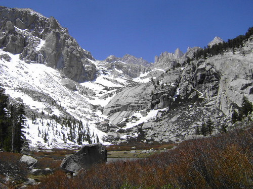
Classic LBSL shot:
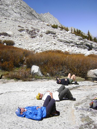
Put the boys down for a nap at Clyde Meadow:
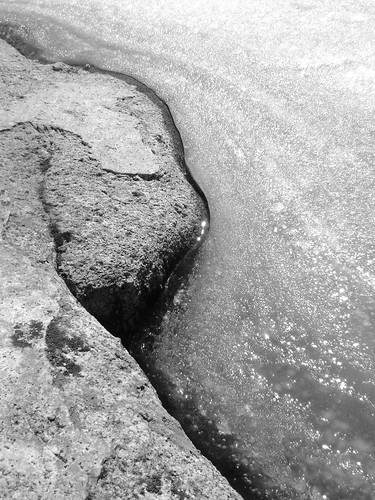
Edge of UBSL:
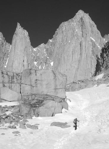
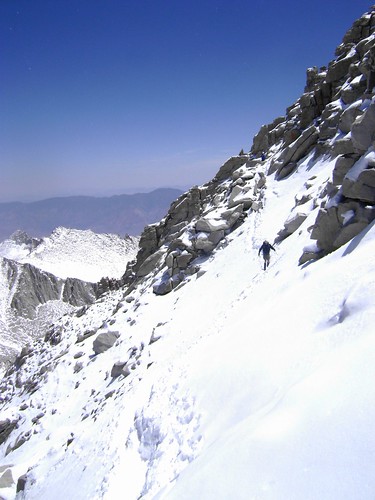
Mike just ahead Sunday morning:
More of the 'easy walk off' (Yeah, right...):
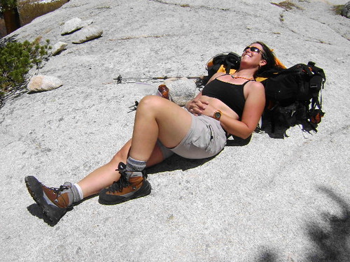
Life is DEFINITELY good:
Rest of the
pics are here. Hope to get labels up in the next few days.
From the luckiest girl in the world, climb hard, be safe!
-L

PS: Happy belated birthday, Sherida!!


