|
|
Joined: Dec 2002
Posts: 1,059 Likes: 3
Member
|
|
Member
Joined: Dec 2002
Posts: 1,059 Likes: 3 |
|
|
|
|
|
Joined: May 2025
Posts: 31 Likes: 12
Member
|
|
Member
Joined: May 2025
Posts: 31 Likes: 12 |
Last edited by JohnJDS; 09/10/25 01:49 PM.
|
|
1 member likes this:
m323393 |
|
|
|
|
Joined: Jun 2003
Posts: 5,760 Likes: 31
Member
|
|
Member
Joined: Jun 2003
Posts: 5,760 Likes: 31 |
Nothing like that feeling of First Tracks…had the pleasure many times in my youth…
|
|
1 member likes this:
JohnJDS |
|
|
|
|
Joined: Dec 2002
Posts: 651 Likes: 12
Member
|
|
Member
Joined: Dec 2002
Posts: 651 Likes: 12 |
John,
Your photos are awesome! Much appreciated.
BTW, any evidence of water still flowing from the Spring at the 23rd Switchback?
Jim
|
|
|
|
|
Joined: Aug 2025
Posts: 2 Likes: 2
Member
|
|
Member
Joined: Aug 2025
Posts: 2 Likes: 2 |
JDS. Thanks for posting photos and trip reports here, and thanks for your great youtube channel as well. I'm a strictly stick to trail hiker in the Sierra but enjoy both your on and off trail videos a lot. Thanks.
|
|
1 member likes this:
JohnJDS |
|
|
|
|
Joined: May 2025
Posts: 31 Likes: 12
Member
|
|
Member
Joined: May 2025
Posts: 31 Likes: 12 |
BTW, any evidence of water still flowing from the Spring at the 23rd Switchback? Just saw this, sorry. Yes, the spring is flowing. Good to see on the way up, I like filling up there on the way down so I can continue past the trail camp tarn.
|
|
|
|
|
Joined: Apr 2022
Posts: 64 Likes: 2
Member
|
|
Member
Joined: Apr 2022
Posts: 64 Likes: 2 |
Seeing snow building up on the MR chute. Is the upper chute/final 400 pretty icy now? Can anyone attest?
|
|
|
|
|
Joined: Dec 2002
Posts: 3,127 Likes: 41
Member
|
|
Member
Joined: Dec 2002
Posts: 3,127 Likes: 41 |
The answer to the age old question how high is up Ongoing research since 1983-1988 NGS elevation adjustment
Last edited by Doug Sr; 09/27/25 12:14 PM.
|
|
1 member likes this:
JohnJDS |
|
|
|
|
Joined: Mar 2024
Posts: 14
Member
|
|
Member
Joined: Mar 2024
Posts: 14 |
October 25 Hike Date
May 2024 was my last attempt and we were in crampons pretty early on for majority of the hike. This we we have a October 25th permit date and I'm wondering if anyone has been up there this time of year. Weather seems to start picking up with temps starts to be colder more frequently. Any expectations on snow on ground? Bigger concerns seems to be quickly shifting weather.
What have late October hikers seen in the past?
|
|
|
|
|
Joined: May 2025
Posts: 31 Likes: 12
Member
|
|
Member
Joined: May 2025
Posts: 31 Likes: 12 |
October 25 Hike Date
May 2024 was my last attempt and we were in crampons pretty early on for majority of the hike. This we we have a October 25th permit date and I'm wondering if anyone has been up there this time of year. Weather seems to start picking up with temps starts to be colder more frequently. Any expectations on snow on ground? Bigger concerns seems to be quickly shifting weather.
What have late October hikers seen in the past? Late October for me in the eastern Sierra is a mixed bag. Could be clear all day, often cloudy, likely windy, maybe flurries. Good mid and shell layers and you're set. Watch the weather every couple days on mountain forecast to follow snowfall / buildup. Early autumn snow is often mostly decorative unless there's a big dump and freeze/thaw to make it solid and icy. I believe I'm up on the 19th? I'll share what I see.
|
|
|
|
|
Joined: Jun 2003
Posts: 5,760 Likes: 31
Member
|
|
Member
Joined: Jun 2003
Posts: 5,760 Likes: 31 |
I love October in the Sierra...the Crowds are gone...
Like John said, you can have Summer Weather, or Winter Weather...Watch the Forecast and look at the Webcams...
It's highly unlikely that there will be any FS Staff on the moutain and NPS will have extracted their personnel long before this, so you can have flexiblity (wink wink) with your permit dates...
If you're camping on the Mountain, carry a couple of days of extra food...you can sit and wait for the snow to melt if you get caught by a minor snowfall...and it will...unless it's a Big Dump...in which case, you weren't watching the forecast...
|
|
|
|
|
Joined: Apr 2022
Posts: 64 Likes: 2
Member
|
|
Member
Joined: Apr 2022
Posts: 64 Likes: 2 |
Sept 28-29 Mountaineer's Route Update: 10th time on Whitney!  Went up Sept 28 to Iceberg Lake. Summited Sept 29th and descended back to Portal. Link to photos/videos:https://drive.google.com/drive/folders/12jQ5vcc8tCvUYnuZJfXTyhLdyF2U506b?usp=sharingSunday, Sept 28:- Ford in first canyon is low and easy - Lower Boy Scout Lake is clear - Upper Boy Scout Lake is clear - Got caught in a snowstorm (dropped 2in) halfway to Iceberg Lake ~3:15pm. Thunder & Lightning. Cowered under some rocks. Lasted about 40min. Was told Upper & Lower Boy scout got some rain as well. -Camped at Iceberg lake. Snow did not thaw which made for a cold night (30 degrees or so) Monday, Sept 29-Started up the chute ~8am (Another storm predicted in afternoon) -Mostly Talus and scree on the way up. -Upper gully was maintaining colder temps, so no thaw/freeze cycle above ~13500ft. Decent amount of snow with rock showing. Did not use crampons as snow was too soft. Did use ice axe, but doable with trekking poles. See pic of "Snowy Upper Gully". -Best route right now once at the notch is the traverse. Final 400 is treacherous and frozen over. Do not recommend... *See pics* -Couple inches of snow blanketing everywhere at the summit. -Made it back down to Iceberg camp, packed up, by the time I was leaving pretty much all snow up to 13500ft was melted and gone at ~1:30pm. -Made it down to Lower Boy Scout lake when the storm rolled in ~3:30pm. Received rain where I was, so probably an inch or so of snow up there again. If going up soon, recommend preparation for spontaneous storms and colder temps. Do your weather and conditions research in advance so you can time it out appropriately. You don't want to be at the summit when there's lightning!  Hope the pics/video help assess conditions! *Disclaimer* - Do not go up Mountaineer's route unless you know what you're doing. And even if you know what you're doing, you are at the mercy of the mountain, so be prepared! All the best!
|
|
1 member likes this:
JohnJDS |
|
|
|
|
Joined: Dec 2002
Posts: 651 Likes: 12
Member
|
|
Member
Joined: Dec 2002
Posts: 651 Likes: 12 |
Hiked the Main Trail yesterday (Wed Oct 1). There were many hikers on the Mountain.
The skies were clear and there were great Fall Colors below Lone Pine Lake.
At the higher elevations it was a bit breezy, but not cold. From the Summit there was incredible visibility in all directions.
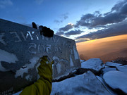
From Trail Crest to the Summit there was a fair amount of snow on the trail. The summit plateau was mostly covered with a few inches of snow.
Coming up from the West, numerous hikers were finishing the JMT and High Sierra Trail. They said that the Crabtree ranger is still on duty.
I carried micro spikes, but only used them to pass the Cables.
The Spring at the 23rd Switchback is done for the season. The creek at Trail Side Meadow still has a good flow.
I returned to the TH at 6 pm, but the Whiney Portal Store had just closed. Fortunately, I was able to say hello to Doug Sr.
Congratulations to Earlene and Doug on their upcoming 60th Wedding Anniversary!
Jim
|
|
1 member likes this:
JohnJDS |
|
|
|
|
Joined: May 2025
Posts: 31 Likes: 12
Member
|
|
Member
Joined: May 2025
Posts: 31 Likes: 12 |
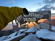
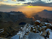
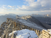
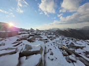
Summited today with a cancelation from inclement weather.
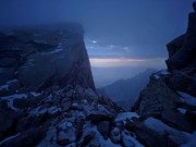
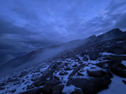
I saw a clear daytime window so I went for it. Rainy at the portal all night, apparently quite the storm up at Trail Camp also all night and morning. I waited for morning light and the rain to clear. Took off at 7am and got a great day hike all in daylight with almost all clear blue skies. The forecast 35 mph winds and 0F temps never transpired. It was comfortable the whole time and I didn't wear half the layers I brought.
Seemed like a lot of people going down in the morning that were caught in the weather and were over it and decided to descend instead. We've all been there I'm sure.
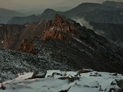
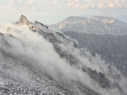
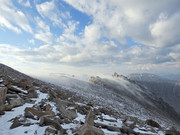
2-12 inch powder drifts from half way up the switchbacks to the summit. Some melting freezing on the lower switchbacks. It's already more comfortable with snow boots without traction. Trail runners with microspikes would work but it will be cold already. Don't know if this will stick. If it freeze thaws and gets another dump on it, who knows.
I made a snow angel.
Last edited by Jeff M; 10/04/25 08:45 AM. Reason: Removed dead image links
|
|
1 member likes this:
m323393 |
|
|
|
|
Joined: May 2025
Posts: 31 Likes: 12
Member
|
|
Member
Joined: May 2025
Posts: 31 Likes: 12 |
Oh no, I’m so sorry about the broken image links
I’m done with postimage. I set the links to never expire but it simply does not work. I can’t edit the post anymore to get rid of them, sorry again for the spam.
|
|
|
|
|
Joined: Dec 2002
Posts: 1,059 Likes: 3
Member
|
|
Member
Joined: Dec 2002
Posts: 1,059 Likes: 3 |
Not spam at all. Good reportage--bad photo hosting is all. I removed the dead links (while I'm waiting at the airport---gotta love technology)
|
|
1 member likes this:
JohnJDS |
|
|
|
|
Joined: May 2025
Posts: 31 Likes: 12
Member
|
|
Member
Joined: May 2025
Posts: 31 Likes: 12 |
I saw forecasts for anywhere between 8 and 20 inches of snow accumulation on the summit today (Tuesday). I wonder what went down? Look forward to checking out the webcams tomorrow.
|
|
|
|
|