|
|
#105282 - 05/01/23 09:08 AM
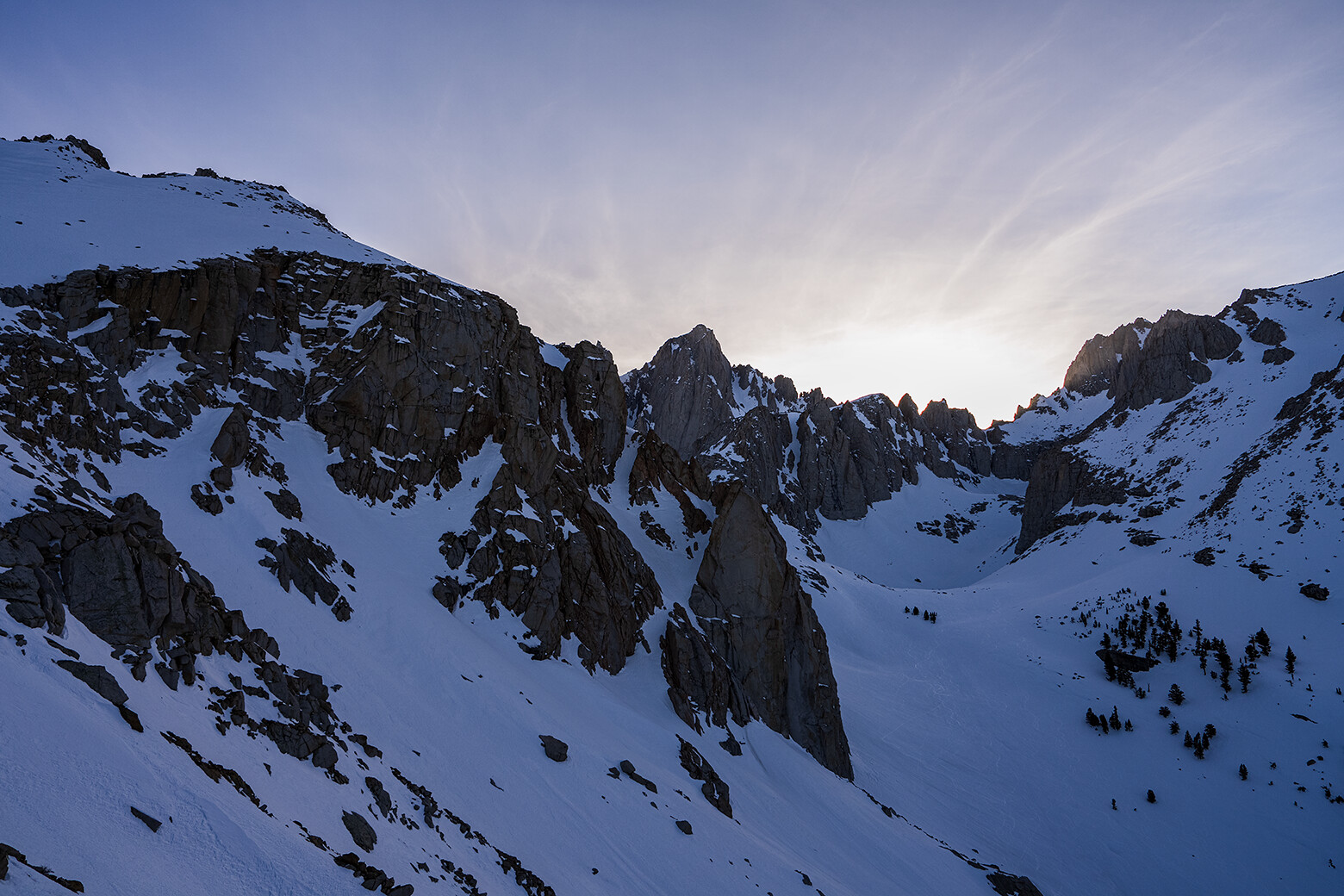
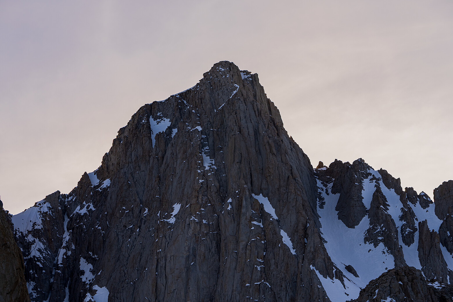
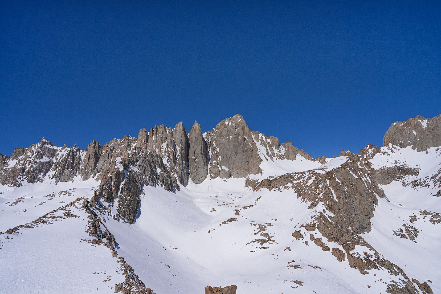
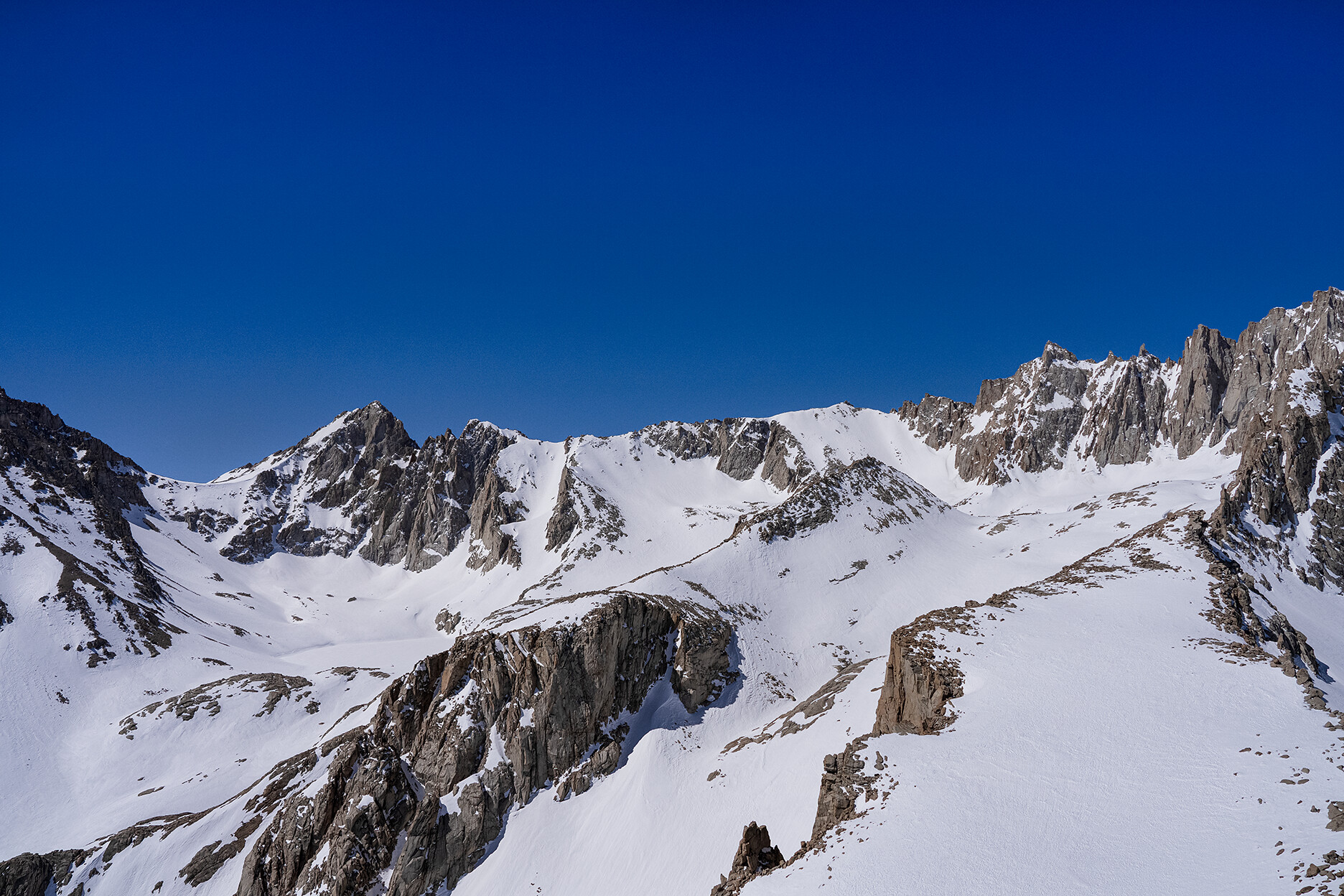
 Mt. Whitney Zone 04/28-29/2023 Pics
|

Member
Registered: 04/30/23
Posts: 14
Loc: Pasadena, CA
|
|
|
Top
|
|
|
|
|
#105285 - 05/01/23 01:53 PM
Re: Mt. Whitney Zone 04/28-29/2023 Pics
[Re: LostInMtn]
|
Member
Registered: 04/29/23
Posts: 6
Loc: Hermosa Beach and Scottsdale
|
Question from a newcomer - Given the many years of experience on this message board and in light of the exceptional amount of snow this year, any predictions what the top half of the Mt Whitney Trail route will look like in early July?
Thank you for all the time and effort put into these posts. It is good information and very helpful.
Foxrider
|
|
Top
|
|
|
|
|
#105287 - 05/01/23 04:01 PM
Re: Mt. Whitney Zone 04/28-29/2023 Pics
[Re: LostInMtn]
|
Member
Registered: 06/26/03
Posts: 5228
Loc: Ridgecrest, CA
|
That's an awesome set of photos.
|
|
Top
|
|
|
|
|
#105289 - 05/01/23 05:15 PM
Re: Mt. Whitney Zone 04/28-29/2023 Pics
[Re: Foxrider]
|

Member
Registered: 12/16/02
Posts: 2955
Loc: Whitney
|
Lets look at it from above 12,000' to trailcrest 13,500 this area will be in transition many will do the chute others will try the trail with sections of snow/ice, the cable area will be the major problem as the end of the cables the trail makes a 180 turn many get to the end or start of the cables and turn around. The back side (west side above trailcrest will have sections of packed snow and ice but mostly clear till the section just before the summit and most will follow a track straight to the summit the area of the last window (Keeler Neddle) this area is about 1000' to the summit and most often a well traveled track in the snow.
Now the lower section will have the 3 main areas of concern these are the water crossings , first about 1/2 mile up the trail, just before Lone Pine Lake (the logs could be washed out, 11 now old days 3) Entering Outpost camp area this first section could be wet/mud and the creek off the waterfall , not deep but wide and the outflow from Mirror Lake will be running over the trail. So I am a walk in water boots on get soaked and move on I don't risk rock hopping , carry an extra pair of socks or two.
This always comes full circle on experience and expectations , a day hike or over several days , where to camp and gear needed. Over the next 8 weeks watch for reports. I always stress photos and experience of the group.Also where do they live! We see many from SoCal that have limited snow experience and others from the northern states that deal with snow every winter.
Please others join in with comments
|
|
Top
|
|
|
|
|
#105292 - 05/01/23 08:00 PM
Re: Mt. Whitney Zone 04/28-29/2023 Pics
[Re: LostInMtn]
|
Member
Registered: 05/01/23
Posts: 2
Loc: Golden Co
|
How were the conditions on Whitney portal road?
|
|
Top
|
|
|
|
|
#105298 - 05/03/23 09:07 AM
Re: Mt. Whitney Zone 04/28-29/2023 Pics
[Re: Doug Sr]
|
Member
Registered: 06/26/03
Posts: 5228
Loc: Ridgecrest, CA
|
Additional confirmation that there are a bunch of idiots who head into the mountains with no clue...Why wouldn't you follow an existing track until you confirm that it's bad???
Question: Where can I stash my bike if I ride up for a little exploring and exercise? Those photos and videos of the mountain have me craving an up-close-and-personal view...
|
|
Top
|
|
|
|
|
#105299 - 05/04/23 11:19 AM
Re: Mt. Whitney Zone 04/28-29/2023 Pics
[Re: LostInMtn]
|
Member
Registered: 01/01/03
Posts: 195
Loc: SoCal
|
LostInMtn,
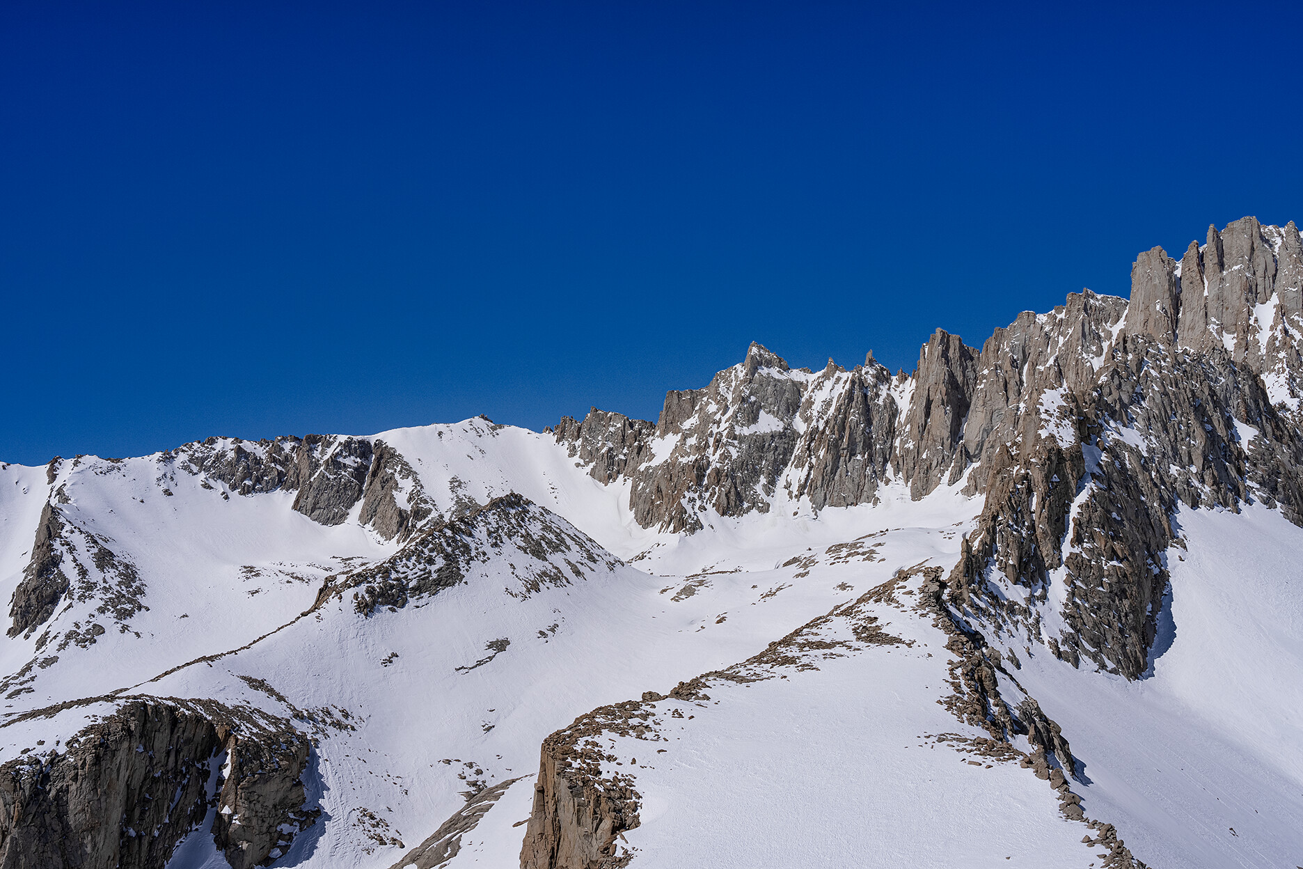
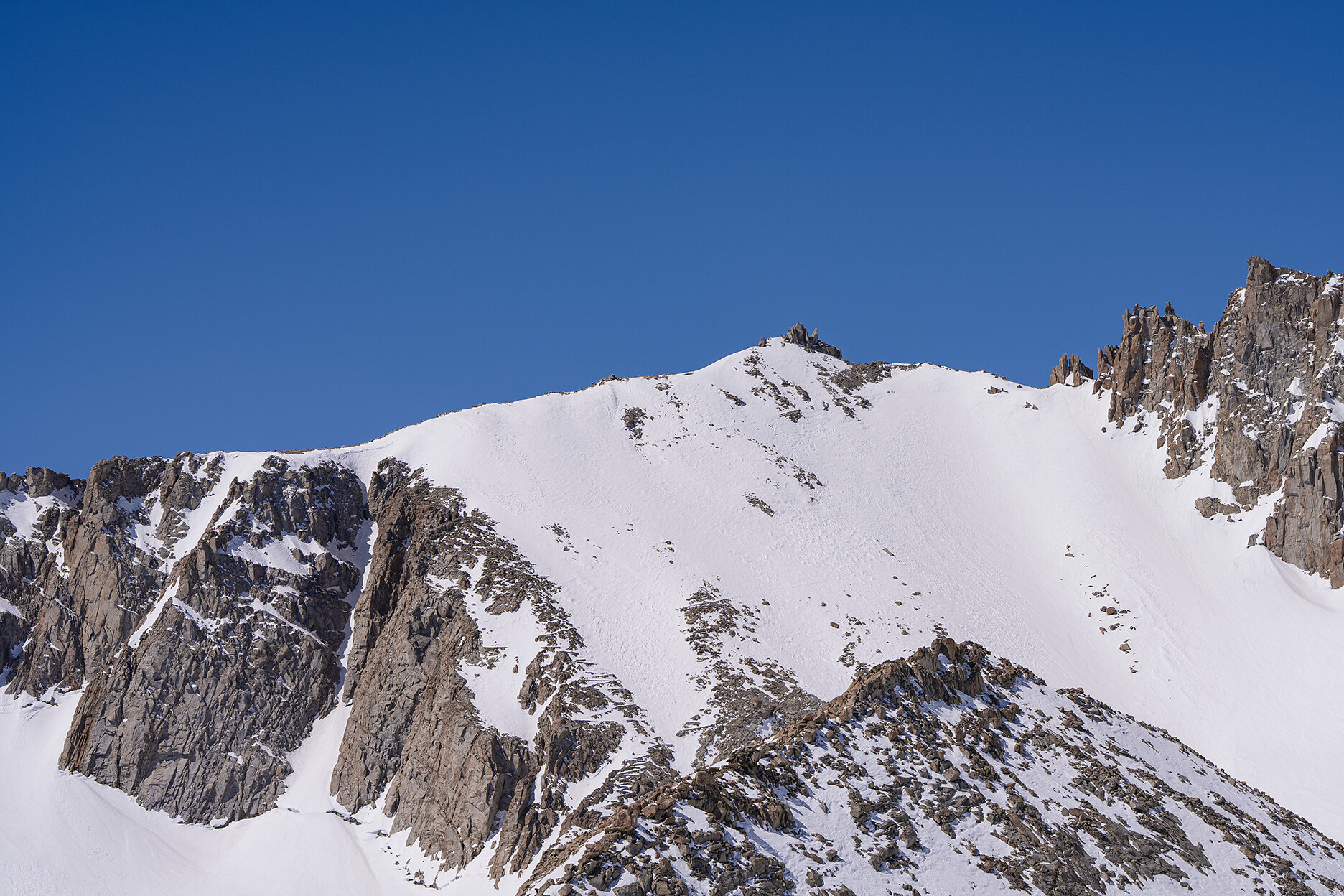
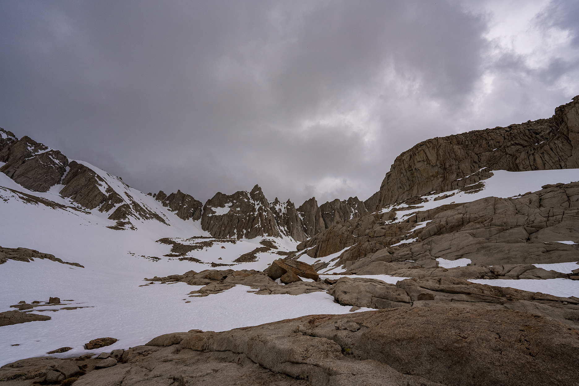
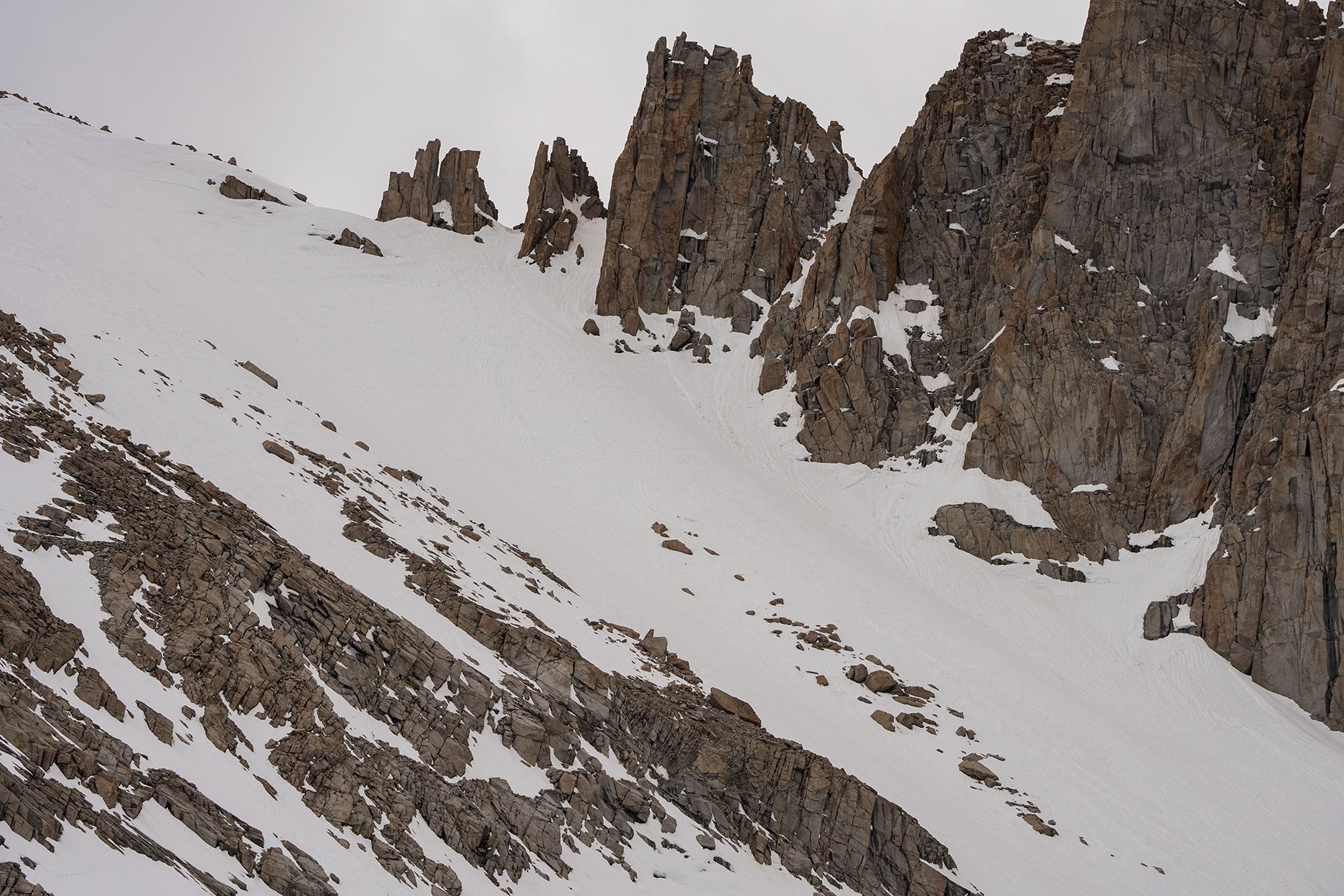
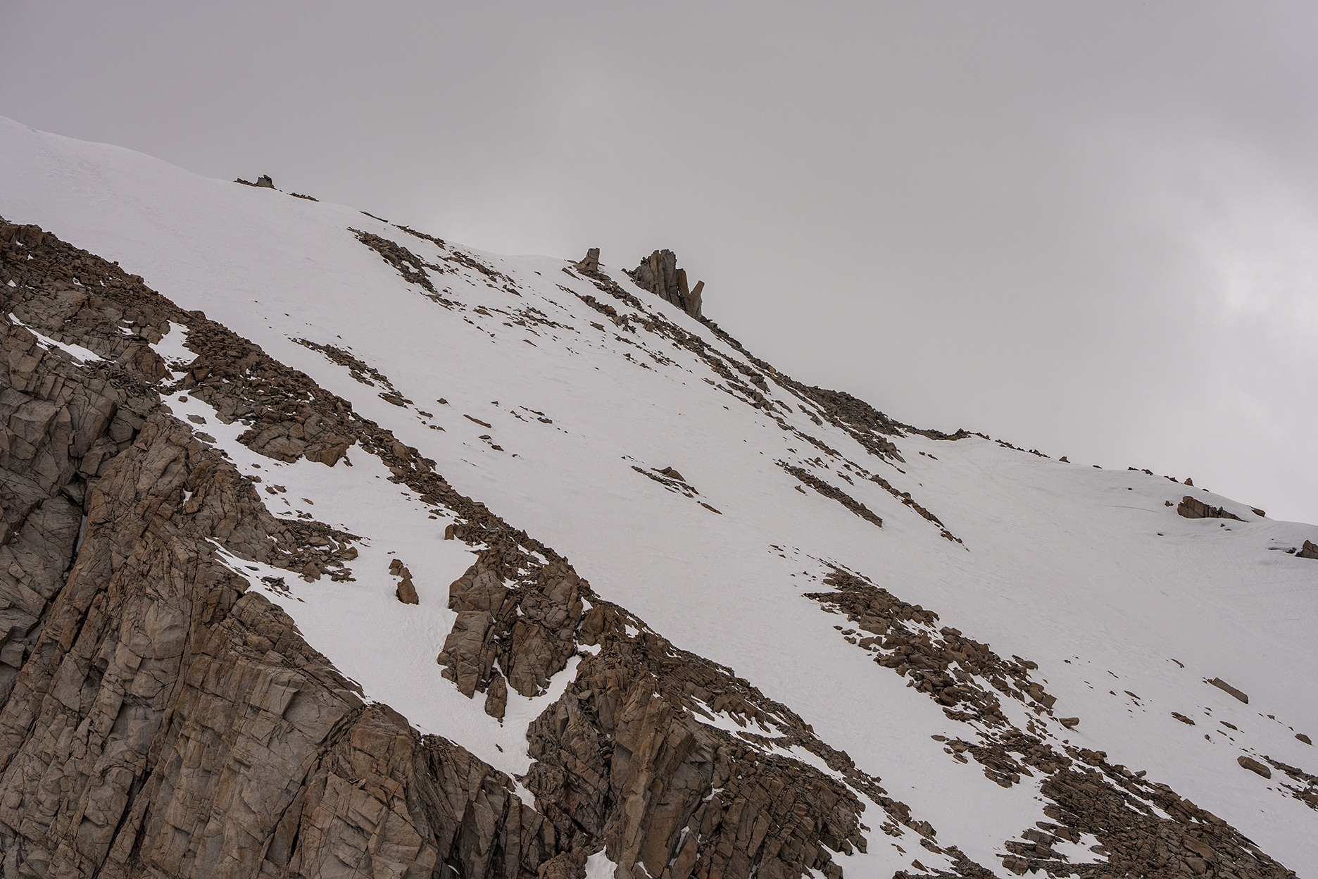
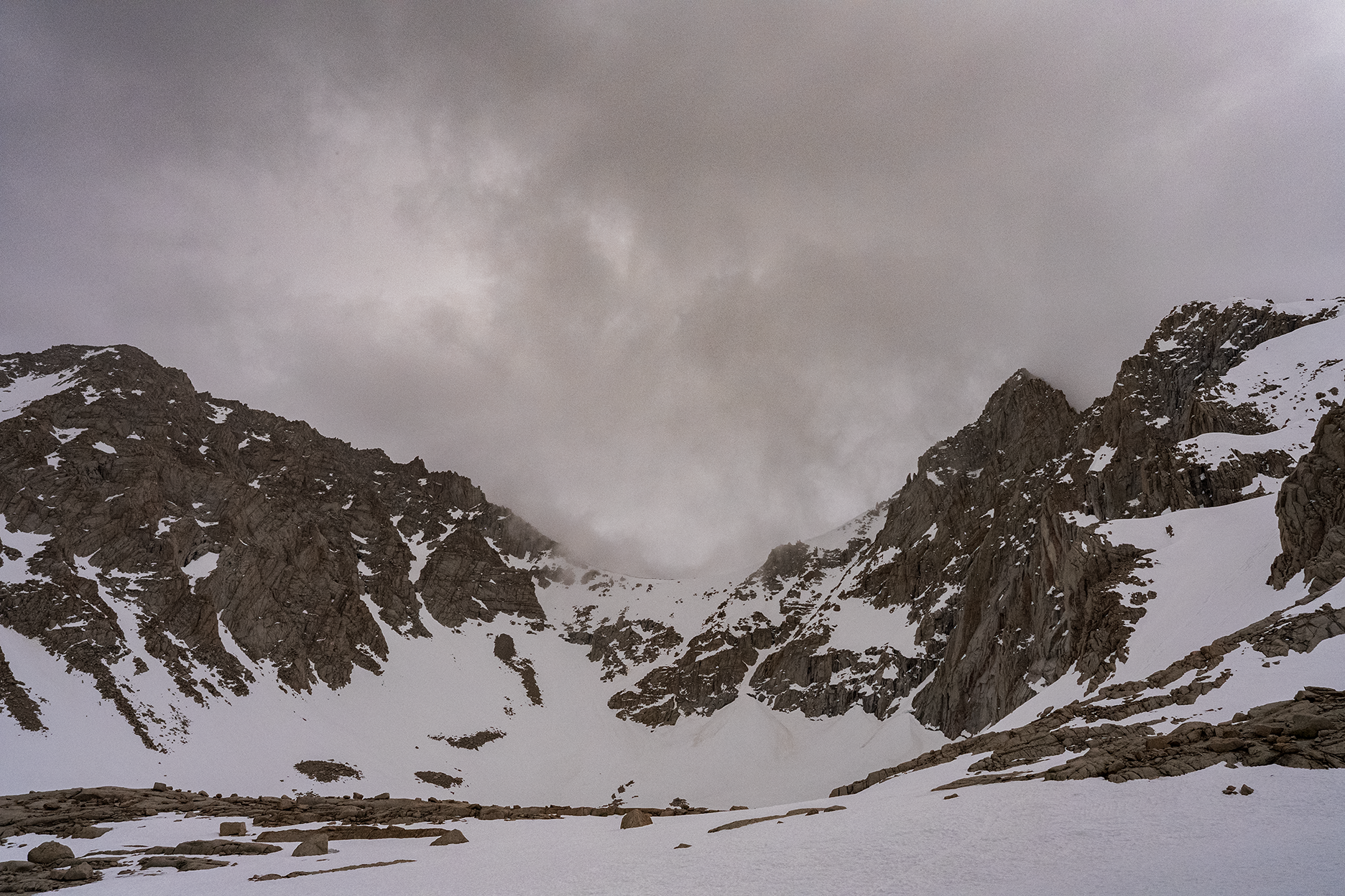
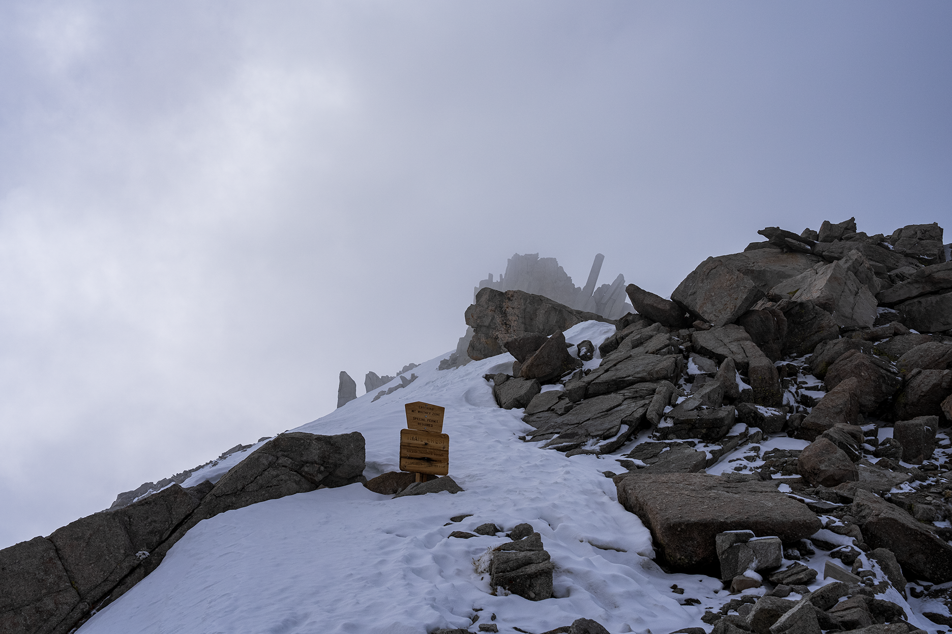
Great photos that show a lot of winter detail.
How did you take the photos? A few appear to have been taken while on foot but the majority of them appear they were either taken from a Drone or Helicopter/Airplane.
If you have others of the popular Eastern Sierra hiking/climbing spots please share them too.
|
|
Top
|
|
|
|
|
#105300 - 05/04/23 12:28 PM
Re: Mt. Whitney Zone 04/28-29/2023 Pics
[Re: LostInMtn]
|
Member
Registered: 05/04/23
Posts: 5
Loc: Massachusetts
|
Hey everyone. I've been lurking for a couple weeks, signed up today so I could post/chat with you folks.
LostInMtn - Absolutely stellar photos! That's a huge help for anyone heading up there early season this year. Thank you for posting.
The 99 switchbacks are certainly snowy, but I was concerned the snowpack would be deeper than it looks there. Nice to see the trail cutting through the slope relatively clearly in this shots.
I'm heading up there in early June with a small group of four - my cousin is the group leader and has done it several times before, but not with this much snow. I'm a ski mountaineer with several higher peaks under my belt, with Rainier and Elbert being my most recent successes in '21 and '22 (on skis). I'm looking forward to attempting the hat trick on Whitney this year. We will be taking the standard route up, no skis - just spikes and axes as needed.
Based on conditions it looks like it will certainly be microspikes and axes/poles. My only question is people's opinion of crampons vs spikes on the 99 switchbacks, once the route is established this month. Any additional photos of the switchbacks and the snowy/icy areas on the west ridge would be appreciated in the coming weeks. I'm quite confident in my own abilites to assess terrain and handle icy conditions with boots/spikes and poles/whippet, but we will have a couple less experienced winter hikers on the trip, so I'm doing my best to assess conditions. I'll be watching closely and mining for beta in the coming month!
Thanks all, glad to be a part of this community. Psyched for our trip.
|
|
Top
|
|
|
|
|
#105301 - 05/04/23 03:11 PM
Re: Mt. Whitney Zone 04/28-29/2023 Pics
[Re: Matt Z]
|
Member
Registered: 12/22/02
Posts: 544
Loc: California
|
LostInMtn,
Thanks for these very informative photos.
Matt Z,
Welcome to the WPS Message Board! You note that your group is heading up the Main Trail in early June. I have a permit for a couple of weeks after you and anticipate close to zero chance I will have the switchbacks available as a sane option. I have recently taken my mountaineering boots, crampons, ice axe,... out of winter storage and been practicing near Donner Pass (Lake Tahoe area) in preparation for ascending the Chute from Trail Camp to Trail Crest. If I see any red flags or get a bad feeling about the wisdom of the hike, I will postpone until later.
Jim
PS: Be ready for flooding on the lower portion of the trail. There are also two miles of Main Trail on the west side to deal with, too.
|
|
Top
|
|
|
|
|
#105303 - 05/05/23 07:53 AM
Re: Mt. Whitney Zone 04/28-29/2023 Pics
[Re: Jim F]
|
Member
Registered: 05/04/23
Posts: 5
Loc: Massachusetts
|
LostInMtn,
Matt Z,
Welcome to the WPS Message Board! You note that your group is heading up the Main Trail in early June. I have a permit for a couple of weeks after you and anticipate close to zero chance I will have the switchbacks available as a sane option. I have recently taken my mountaineering boots, crampons, ice axe,... out of winter storage and been practicing near Donner Pass (Lake Tahoe area) in preparation for ascending the Chute from Trail Camp to Trail Crest. If I see any red flags or get a bad feeling about the wisdom of the hike, I will postpone until later.
Jim
PS: Be ready for flooding on the lower portion of the trail. There are also two miles of Main Trail on the west side to deal with, too.
Thanks Jim F. Yes I imagine Lone Pine Creek will be raging for quite some time. We'll develop a plan for water crossings. As for your comment about the sanity of the 99 in the near future - can you just elaborate on your point? Normally I would also just send the chute option with proper crampons, but with the group we have I'd rather stick to the marked trail if possible. Do people simply avoid the 99 altogether in these conditions typically? I was figuring that there would be a somwhat established boot pack through the switchbacks by June. I'm sure the cable sections will be cruxy, but is the consensus that it will be impassable or simply challenging? The west side I'm less worried about. I know there are a few more ice patches to contend with but it's less committing than the cables and a bit less exposed in terms of sheer cliff drops. If we can make trail crest safely I think we'll be in good shape - but as always we will make that decision when we get there. The switchbacks are my biggest question mark. If they are still "safe" with spikes I think it's our best option, but if the chute is the default route in these conditions than we can still pivot to proper crampons. I'm not a huge fan of glissading though. Either way, we will be planning for a very alpine start.
|
|
Top
|
|
|
|
|
#105304 - 05/05/23 08:49 AM
Re: Mt. Whitney Zone 04/28-29/2023 Pics
[Re: Hiiker]
|
Member
Registered: 04/30/23
Posts: 14
Loc: Pasadena, CA
|
I took all of them while on foot between Outpost Camp and Trail Camp and from Thor Peak.
I didn't have time to climb up to Trail Crest and take some pics of the west side. Maybe I'll come back in a week to finish.
|
|
Top
|
|
|
|
|
#105305 - 05/05/23 12:30 PM
Re: Mt. Whitney Zone 04/28-29/2023 Pics
[Re: LostInMtn]
|
Member
Registered: 06/26/03
Posts: 5228
Loc: Ridgecrest, CA
|
|
|
Top
|
|
|
|
|
#105306 - 05/05/23 02:40 PM
Re: Mt. Whitney Zone 04/28-29/2023 Pics
[Re: Richard P.]
|
Member
Registered: 04/30/23
Posts: 14
Loc: Pasadena, CA
|
 Blue - up Red - down
|
|
Top
|
|
|
|
|
#105307 - 05/06/23 06:37 PM
Re: Mt. Whitney Zone 04/28-29/2023 Pics
[Re: Matt Z]
|
Member
Registered: 12/22/02
Posts: 544
Loc: California
|
Matt,
Sorry my statement was ambiguous. Perhaps it helps if it is replaced by "I anticipate close to zero chance that I and other run-of-the-mill hikers will have the switchbacks as a desirable option compared to going up the snow chute to Trail Crest." With my skill set and age, my objective is to attempt to get up and down the Mountain in a relatively safe, controlled, and enjoyable manner. Very strong mountaineers have many more options than I do.
A few times in early season, I thought I could make it up the switchbacks, but tough going forced me to transition over the snow chute.
On the switchbacks, for me an area of more concern than the Cables is the switchbacks just above the Cables. At the Cables, a slip can be protected by the Cables. A slip 100' above the Cables might send one tumbling real fast over the Cables. As I recall, transitioning to the Chute from the area just above the Cables might not be trivial. Though from the Cables with deep snow, I have down climbed directly from the Cables and then traversed left over into the chute to Trail Crest.
Early June is rapidly approaching. With no crystal ball available, I am starting to gather data points on conditions and will focus on gear and skill sets to deal with several of the conditions that might present on the day of my hike.
Looking forward to a great and "interesting" season in the High Sierras.
Jim
|
|
Top
|
|
|
|
|
#105315 - 05/08/23 02:40 PM
Re: Mt. Whitney Zone 04/28-29/2023 Pics
[Re: LostInMtn]
|
Member
Registered: 05/04/23
Posts: 5
Loc: Massachusetts
|
Jim and Doug,
Thanks for the explanation. It seems pretty clear the chute will likely be the safer option on that east face, which makes sense given my other research as well. Obviously it's better to be on a 33* snow chute with consistent grade and minimal rock exposure than it is to be perched on the rocky switchbacks covered in ice and snow.
We will adjust our plans accordingly.
|
|
Top
|
|
|
|
|
#105369 - 05/22/23 06:11 PM
Re: Mt. Whitney Zone 04/28-29/2023 Pics
[Re: LostInMtn]
|
Member
Registered: 04/30/23
Posts: 14
Loc: Pasadena, CA
|
|
|
Top
|
|
|
|
|
|


 Previous Topic
 Index
Index